SVDESIGNER
Contact us:
TEL: +086-010-50951355 / FAX:+86-010-50951352
Email : cathy@souvr.com / Frank@souvr.com / Robin@souvr.com / sales@souvr.com
Details
Related
Consulting
※Product Overview※
SVDESIGNER
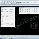
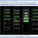
SVDESIGNER™ is a user-friendly 3D conceptual model builder used to significantly reduce model creation times by visualizing, optimizing, and merging engineering-staged construction/design, topology, borehole, piezometer/field instrumentation geotechnical data into a well-defined conceptual model for subsequent numerical modeling.

CAPABILITIES
Calculate material volumes
Volumes of material can be calculated to aid in construction activities.
Create construction sequences
Construction Sequences: Sequences of layers or lifts of material as placed in earth dams or in mining operations can be easily represented in the 3D conceptual model.
Create models quickly
Featuring a familiar user interface with easy-to-understand icons and functions. The software features behave exactly how you would expect with a short learning curve. You will be able to start modeling right away.
Create stunning client visuals
3D conceptual designs can be captured for display to clients and review of potential designs. Image draping of aerial site photos is supported. Fly-bys of sites can be created and exported as animations.
Edit geometry
A rich variety of functionality is implemented in the software to allow editing of existing geometry. This represents the integration of new geotechnical designs with existing topology. Editing features integrate with both surface grids and meshes.
Export to numerical modeling modules
2D or 3D representations of geometry scenarios can be exported to any of the SOILVISION numerical modeling modules for analysis. Exported models can utilize grids or triangulated meshes.
Generate depositional surfaces
Generate a set of slurried depositional surfaces for a user-defined filling scenario. A subsequent fitting curve showing elevation versus volume can be generated.
Import boreholes
Import lithology data from a CSV file or a gINT database into SVDESIGNER.
Import multiple file types
The majority of common 3D file storage types are considered. This allows SVDESIGNER to provide an amalgamated 3D site view of relevant data on a consistent coordinate system.
Integrate field data
Integrated field data, such as piezometer data, can be pulled from the sensemetrics cloud platform to display piezometer locations and water levels as a function of time.
Intersect surfaces
Intersections of surfaces represented as grids, TINs, or MVMs can be accomplished.
Make surface cuts
Cuts into topography can easily be performed as designing a road cut into a hillside. Mining cuts, such as with open pits, can also be represented.
Represent complex 3D surfaces
3D surfaces can be imported from a variety of formats and represented as grids or triangulated surfaces consisting of hundreds of thousands of individual elements.


