HOT
 Production-Quality Lenses Directly from SLA 3D P…
 Forging Ahead with Solar Energy and GibbsCAM CNC…
 GibbsCAM Software Helps Race-Team Mechanics Beco…
 Metro Aerospace Introduces 3D Printed Part for F…
 GibbsCAM Enables Rover Exploration Vehicle Parts…
 Designing a Custom Boot for an Injured Penguin
 Asano Uses Geomagic 3D Scan Software to Drive In…
WAMbot
Ground robots are already commonly used tools in the disposal of explosives, in urban areas and defense missions alike. Recently, there has been a growth in the number of purposes for unmanned ground vehicles. Examples of these purposes can be reconnaissance, surveillance and mapping.
Reconnaissance missions can include the location of persons in a collapsed building or the localization of ambushes in a combat situation. For mapping missions, an unknown area can be mapped using laser scanners and SLAM techniques.

MAGIC 2010 is a competition created by the Australian and US Departments of Defence to develop next-generation autonomous ground vehicle systems. The challenge consists of building a fleet of robots for autonomous surveillance and mapping of a 500mx500m urban area in less than 3.5 hours.
For the orientation and navigation of the robots, 2 out of the 12 shortlisted teams used Xsens MTi’s. The MAGICian team from Australia and the Cappadocia team from Turkey eventually finished 4th and 5th at the Grand Challenge.
WAMbots
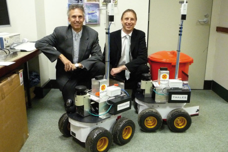
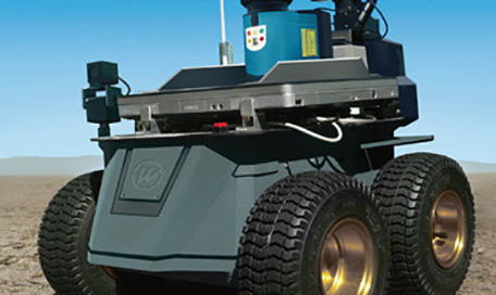
For their WAMbots the Western Australia MAGIC 2010 Robotics Team (consisting of members from the University of Western Australia (UWA), Edith Cowan University (ECU) and Thales Australia, headed by Dr. Adrian Boeing from ECU) is sponsored by Xsens by providing MTi orientation sensors. The MTi is a miniature, gyro-enhanced Attitude and Heading Reference System (AHRS). Its internal low-power signal processor provides drift-free 3D orientation as well as calibrated 3D acceleration, 3D rate of turn and 3D earth-magnetic field data. The MTi is an excellent measurement unit (IMU) for stabilization and control of cameras, robots, vehicles and other (un)manned equipment.

Adrian Boeing adds: “We use the MTi sensors on the WAMbot vehicles to help accurately determine the vehicles position. This includes fusing the IMU data with the wheel encoders to obtain an improved real-time estimate of the vehicles position, as well as using the IMU heading to add ground-truth orientation information into the Simultaneous Localization and Mapping (SLAM) algorithms (LIDAR data is provided by SICK LMS 111 laser scanners (range 20m)). We also use the MTi data to determine the underlying terrain, e.g. if we are driving up a ramp. We found the MTi sensor very easy to work with from both a hardware and software perspective. Thanks to the software provided and open source software we were able to test the sensor and complete the code to interface with the device in less than a week. The inbuilt filters have saved our team many man-days of effort and provide a fast and accurate estimate of the sensors orientation. The Xsens MTi outperformed a number of other sensors that we trialed from other manufacturers.”
For more information on the MTi and MTi-G and other application stories, please visit the industrial applications portal.


