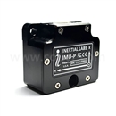
GPS-Aided Inertial Navigation Systems (INS)
Contact us:
TEL: +086-010-50951355 / FAX:+86-010-50951352
Email : cathy@souvr.com / Frank@souvr.com / Robin@souvr.com / sales@souvr.com
Details
Related
Consulting
※Product Overview※
GPS-Aided Inertial Navigation Systems (INS)
GPS-Aided INS key performance
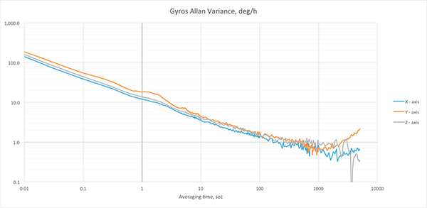
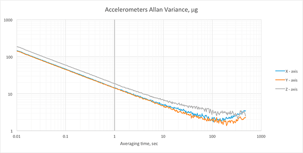
Gyroscopes & Accelerometers Bias in-run stabilit
Heading, Pitch & Roll accuracy

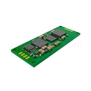
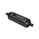
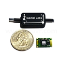
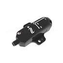
The Inertial Labs Single and Dual Antenna GPS-Aided Inertial Navigation System – INS is a new generation of fully-integrated, combined L1 & L2 GPS, GLONASS, GALILEO and BEIDOU navigation and high-performance strapdown system, that determines positions, altitude, velocity, heave and absolute orientation (Heading, Pitch and Roll) for any device on which it is mounted. Horizontal and Vertical Position, Velocity, Heave and Orientation are determined with high accuracy for both motionless and dynamic applications.
The Inertial Labs INS utilizes advanced GNSS receiver, barometer, 3-axes each of calibrated in full operational temperature range precision Fluxgate magnetometers, tactical grade Accelerometers, and Gyroscopes to provide accurate Position, Velocity, Heading, Pitch and Roll of the device under measure.
INS contains Inertial Labs new on-board sensors fusion filter, state of the art navigation and guidance algorithms and calibration software.
| INS-B-OEM Basic | INS-B Basic | INS-P Professional | INS-D-OEM, INS-DL-OEM Dual Antenna | INS-D, INS-DL Dual Antenna | |
| GNSS constellations & corrections | GPS L1/L2/L5; GLONASS L1/L2; BeiDou B1/B2/B3; GALILEO E1/E5; SBAS; DGPS; RTK | ||||
| Position accuracy | 1.5 m (GPS L1); 1.2 m (GPS L1/L2); 0.6 m (SBAS); 0.4 m (DGPS); 0.01 m (RTK); 0.005 m (PPK) | ||||
| GNSS and IMU raw data output | YES | ||||
| LiDAR, Sonar & Optical camera compatibility | YES | ||||
| Input data | Marine application: DVL (Doppler Velocity Log) Land application: Odometer, Wheel sensor, Encoder, DMI Aerial application: Wind sensor, Air Speed Sensor, Doppler shift from locator (for long-term GPS denied) | ||||
| Output data | Positions, Heading, Dual antenna Heading (D/DL), Pitch, Roll, Velocity, Accelerations, Angular rates, Barometric data, PPS, Direct AT_ITINS message with Position, Heading, Pitch & Roll to COBHAM AVIATOR UAV 200 | ||||
| Heading accuracy | 1 deg (SP) 0.03 deg (PPK) | 0.4 deg (SP) 0.03 deg (PPK) | 0.05 deg (SP) 0.03 deg (PPK) | ||
| Pitch & Roll accuracy | 0.1 deg (SP); 0.006 deg (PPK) | ||||
| IMU | Tactical-grade 1 deg /hr Gyroscopes, 0.005 mg accelerometers Bias in-run stability | ||||
| Size | 85 x 47 x 36 mm | 120 x 50 x 53 mm | 120 x 50 x 53 mm | 85 x 47 x 36 mm | 120 x 50 x 53 mm |
| Weight | 115 gram | 220 gram | 280 gram | 115 gram | 320 gram |
Key Features and Functionality Below
• State-of-the-art algorithms for different dynamic motions of Helicopters, UAV, UUV, UGV, AGV, ROV, Gimbals and Land Vehicles
• Single and Dual antenna GNSS receivers
• 1.5 meters L1 GPS & GLONASS Horizontal Position Accuracy
• 1.2 meters L1, L2 & GLONASS Horizontal Position Accuracy
• 60 cm SBAS Horizontal Position Accuracy
• 40 cm DGPS Horizontal Position Accuracy
• 0.5 cm Post Processing (PP) Horizontal Position Accuracy
• 1 cm + 1ppm RTK Horizontal Position Accuracy
• Up to 50 Hz GNSS positions data rate
• Up to 20 Hz GNSS measurements (raw) data rate
• 1 deg/hr gyroscopes Bias in-run stability
• 5 μg accelerometers Bias in-run stability
• 0.08 deg GNSS Heading and 0.4 deg Gyro-Stabilized Slaved Magnetic Heading accuracy (3 sigma)
• Highly accurate, reliable and temperature stable Fluxgate magnetometers (in-house technology)
• Advanced, extendable, embedded Kalman Filter based sensor fusion algorithms
• Full temperature calibration of all sensing elements
• Environmentally sealed (IP67)
• Compact design
• ROS, LabVIEW, Novatel IE support


